Clementine
BMDO/NASA (US) · Orbiter · 1994Partial
Mapped the whole Moon Feb 26 to Apr 22, 1994 (297 orbits, about 1.6 million images); left lunar orbit May 3, 1994; a thruster fault on May 7 ended the Geographos flyby plan; mission terminated Aug 8, 1994.
TL;DR· 7 min read
Clementine was a Pentagon missile-defense technology demonstration that ended a 21-year American absence from the Moon. Built in 22 months for less than $80 million, it mapped the entire lunar surface in 297 orbits between February and April 1994, about 1.6 million images and the first good look at both poles. Its 1996 bistatic radar hint of south-pole ice remains contested, but it painted the target every polar lander since has aimed at. A thruster fault on May 7, 1994 ended the asteroid encore after every lunar objective had been met.
Clementine is the mission that reopened the Moon: a Pentagon missile-defense technology demonstration that ended a 21-year American lunar absence, gave scientists their first complete look at the lunar surface including the poles, and returned the bistatic radar hint of south-pole ice that every polar lander of the Artemis era is still chasing. Built in 22 months for under 80 million dollars and named for the song's miner's daughter because it would eventually be lost and gone forever, it was: a thruster fault four days after it left lunar orbit killed the asteroid encore, though only after every lunar objective had been met.
Facts as of July 20, 2026, from the sources listed below.
1.6M
digital images returned in two months of lunar mapping
297
lunar orbits flown between February 19 and May 3, 1994
21years
since the previous US Moon mission (Explorer 49, 1973)
<$80M
build cost; NRL completed the spacecraft in 22 months
Commonly wrong. Three recurring errors in English coverage. (1) "Clementine discovered water ice on the Moon": it did not. The 1996 bistatic radar result was a suggestive polarization signature over the shadowed south pole, a Stanford reanalysis could not confirm it, and 2006 Arecibo observations found the same signature in sunlit terrain, so the specific claim remains contested; the neutron evidence for polar hydrogen came from Lunar Prospector in 1998 and the direct water measurement from LCROSS in 2009. Clementine started the hunt; it did not settle it. (2) On "the first US Moon mission since Apollo 17": the last US lunar mission before Clementine was the Explorer 49 radio astronomy orbiter of June 1973, so the correct figure is a 21-year gap; the 22-year version measures back to Apollo instead. (3) On "the mission failed": every lunar objective was complete before the May 7, 1994 thruster fault; what was lost was the asteroid Geographos extension.
01Mission facts
Program
Deep Space Program Science Experiment (DSPSE); a technology proving mission for the Strategic Defense Initiative's Brilliant Pebbles concept, managed jointly by the Ballistic Missile Defense Organization and NASA↗
Builder
US Naval Research Laboratory, which completed the spacecraft in 22 months for less than $80 million and flight-tested 23 advanced lightweight technologies (NRL figures)↗
Launch
January 25, 1994, 16:34 UT, on a Titan 2G (vehicle 23G-11) from Vandenberg Air Force Base SLC-4W, California↗
Return to the Moon
First US mission to the Moon in 21 years; the previous one was the Explorer 49 radio astronomy orbiter, launched June 1973↗
Mass
227 kg dry, 424 kg with propellant; total launch mass 1,690 kg, most of it the solid rocket motor for translunar injection↗
Sensors
UV/Visible camera, near-infrared camera, long-wave infrared camera, high-resolution camera, two star tracker cameras, LIDAR laser altimeter, and a charged particle telescope↗
Lunar orbit insertion
February 19, 1994, into an elliptical polar orbit of roughly 430 x 2,950 km↗
Mapping output
About 1.6 million digital images over two months, many at resolutions of 100-200 m, giving scientists their first look at the total lunar landscape including the polar regions; 297 lunar orbits in all↗
Topography
The laser altimeter profiled the South Pole-Aitken Basin as a topographic rim about 2,500 km in diameter with an irregular depressed floor about 12 km deep↗
Bistatic radar result
A same-sense circular polarization enhancement localized to the permanently shadowed south polar region and absent from periodically sunlit terrain, including the north pole; the probable explanation offered was low-loss volume scattering by deposits such as water ice (Nozette et al., Science, Nov 29, 1996)↗
Ice announcement
December 3, 1996: Department of Defense officials announced evidence of ice in the bottom of a permanently shadowed south pole crater, estimated at 60,000 to 120,000 cubic meters↗
The counter-evidence
Arecibo radar observations published in 2006 (Campbell et al., Nature) found the same radar signatures in sunlit terrain where ice cannot survive, concluding there was no evidence for thick ice deposits near the south pole; surface roughness explains the signal equally well↗
02Mission timeline
25 Jan 1994
Launched at 16:34 UT on a Titan 2G from Vandenberg Air Force Base, the first US spacecraft sent to the Moon in over 20 years
19 Feb 1994
Entered an elliptical polar lunar orbit of about 430 x 2,950 km after phasing orbits and an Earth flyby
26 Feb 1994
Systematic mapping begins from a five-hour polar orbit
9 Apr 1994
Bistatic radar pass: the spacecraft beams its 13-cm radio signal onto the shadowed south polar terrain while Deep Space Network antennas on Earth listen for the echo
22 Apr 1994
Mapping campaign complete: the entire lunar surface imaged, including the first good look at both poles
3 May 1994
Thrusters fire to leave lunar orbit, targeting an August 1994 flyby of near-Earth asteroid 1620 Geographos via an Earth flyby
7 May 1994
A computer fault at 14:39 UT fires an attitude control thruster for 11 minutes, exhausting the propellant and leaving the spacecraft in an uncontrollable spin; the asteroid flyby is abandoned
20 Jul 1994
Lunar gravity takes control of the crippled spacecraft and propels it into heliocentric orbit
8 Aug 1994
Mission terminated when falling power levels no longer allow clear telemetry exchange
20 Feb to 10 May 1995
Ground controllers briefly regain contact after the derelict fortuitously drifts into an attitude that lets it power up
29 Nov 1996
Nozette and colleagues publish the bistatic radar experiment in Science, reporting a polarization signature over the shadowed south pole consistent with water ice
3 Dec 1996
The Department of Defense announces evidence of ice in a permanently shadowed crater at the lunar south pole
1998 to 1999
A Stanford reanalysis of the raw bistatic echoes cannot confirm an enhancement unique to the south pole; meanwhile Lunar Prospector's neutron spectrometer independently finds hydrogen at both poles in March 1998
19 Oct 2006
Arecibo observations published in Nature find identical radar signatures in sunlit terrain, concluding there is no evidence for thick polar ice deposits; Clementine's specific radar claim remains contested
Teal dots: events that physically happened in flight or on the Moon. Grey: announcements, namings, contracts, and targets.
03The mission
Clementine was not conceived as a Moon mission at all. Officially the Deep Space Program Science Experiment, it existed to flight-qualify lightweight sensors and spacecraft components developed for the Strategic Defense Initiative's Brilliant Pebbles interceptor concept, and the Pentagon's Ballistic Missile Defense Organization wanted a demanding, distant proving ground for them. The Moon was the test range; NASA joined to make sure the data did science on the way through. The US Naval Research Laboratory designed, built and flew the 227 kg (dry) spacecraft in 22 months for less than 80 million dollars, startling numbers in an era when planetary missions took a decade and cost billions. The team named it after the folk ballad "Oh My Darling, Clementine": like the miner's daughter of the song, the fuel-limited little spacecraft would in the end be lost and gone forever.
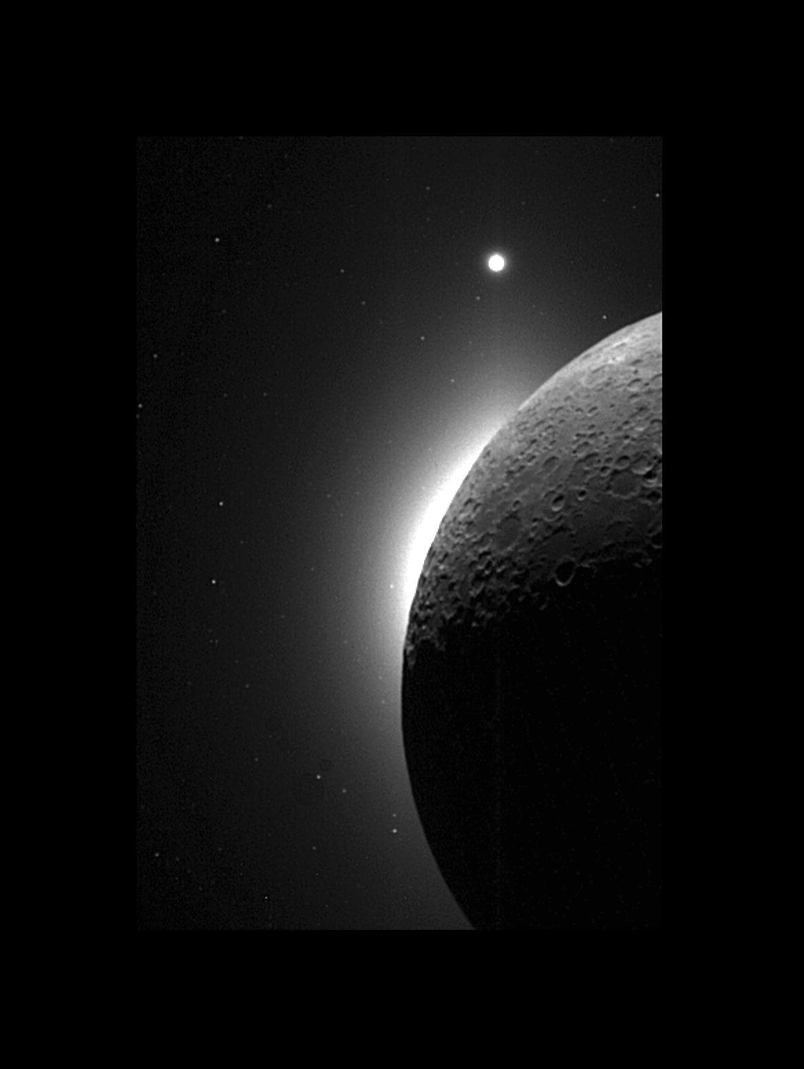
It launched on January 25, 1994, on a Titan 2G from Vandenberg Air Force Base, the first American spacecraft sent to the Moon in 21 years, since the Explorer 49 radio observatory of 1973. On February 19, 1994 it entered an elliptical polar orbit of roughly 430 by 2,950 kilometers, and from February 26 to April 22 it ran one of the most efficient mapping campaigns ever flown: about 1.6 million digital images by NASA's count (NRL puts it near two million), covering the entire lunar surface, much of it at 100 to 200 meters per pixel, in 297 orbits. It was the first time anyone had seen the whole Moon, poles included, and its laser altimeter revealed the true scale of the South Pole-Aitken Basin, a topographic rim about 2,500 kilometers across around a floor depressed some 12 kilometers.
The mission's most consequential moment was an improvisation. On April 9, 1994, controllers pointed the spacecraft's transmitter at the permanently shadowed terrain near the south pole and had Deep Space Network antennas on Earth catch the reflected signal. When Nozette and colleagues published the analysis in Science on November 29, 1996, they reported a same-sense circular polarization enhancement localized to the shadowed south polar region and absent over sunlit ground, with low-loss volume scattering by water ice offered as the probable explanation. The Pentagon announced the result on December 3, 1996, sizing the possible deposit at 60,000 to 120,000 cubic meters. The claim was contested almost immediately: a Stanford reanalysis of the raw echoes could not find an enhancement unique to the pole, and in 2006 Arecibo radar observations found identical signatures in sunlit crater ejecta where ice cannot survive, showing surface roughness explains the signal just as well. Clementine's radar hint was never proof. But it put the question on the table: Lunar Prospector's neutron spectrometer found polar hydrogen in 1998, LCROSS measured actual water in a 2009 impact plume, and the entire south pole fixation of the Artemis era descends from the target Clementine painted.
The asteroid encore never happened. On May 3, 1994, Clementine fired its thrusters to leave lunar orbit for an August 1994 flyby of near-Earth asteroid 1620 Geographos, but on May 7 a computer fault commanded an attitude control thruster to fire for 11 minutes, spending the remaining propellant and spinning the spacecraft up to about 80 revolutions per minute. With useful asteroid observations impossible, controllers brought the spinning spacecraft back to the vicinity of Earth; on July 20, 1994, lunar gravity took control of the derelict and propelled it into orbit around the Sun, and the mission was terminated on August 8, 1994, when falling power levels no longer allowed clear telemetry. There was one last flourish: between February 20 and May 10, 1995, the derelict drifted into an attitude that let it power up, and controllers briefly heard from Clementine again.
The deepest legacy is procedural. NASA credits Clementine's management methods as the foundation of the "faster, better, cheaper" approach and the Discovery Program that followed, and NRL calls its multispectral dataset the basis of the most comprehensive lunar geological map of its time. Strategically it did something larger: it converted the Moon from a finished Apollo-era museum piece back into an unfinished world with resources worth prospecting. The 21-year hiatus in American lunar exploration ended with a missile-defense testbed the size of a refrigerator, and every ice-hunting lander now aiming at the south pole is following a trail Clementine marked first.
04In pictures
Tap a photo to enlarge.
05Sources
- NASA Science: Clementine mission page (launch, orbit, 1.6M images, 297 orbits, Geographos plan, May 7 fault, Aug 8 termination, 1995 contact, Dec 3 1996 ice announcement, Brilliant Pebbles, faster-better-cheaper legacy)
- NRL via DVIDS: 25th anniversary of Clementine (22 months, under $80M, 23 technologies, Titan IIG, five-hour polar orbit, Feb 26 to Apr 22 mapping, naming after the ballad)
- eoPortal: Clementine (spacecraft masses, instrument suite, 80 rpm spin)
- Nozette et al. 1996, Science: The Clementine Bistatic Radar Experiment (polarization enhancement at the shadowed south pole, ice interpretation)
- Simpson and Tyler, NASA NTRS: Reanalysis of Clementine Bistatic Radar Data from the Lunar South Pole (April 9, 1994 pass; enhancement not unique to the pole)
- Campbell et al. 2006, Nature: No evidence for thick deposits of ice at the lunar south pole (Arecibo radar)
- NASA Science: Explorer 49 (final US Moon mission for 21 years until Clementine)
- NASA Science: Lunar Prospector (March 1998 announcement of water ice evidence at both poles)
- Astronomy.com: Feb. 19, 1994, Clementine enters lunar orbit (first US voyage to the Moon in over two decades; 11-minute thruster misfire)
- NASA images library: PIA00304, farside view (Clementine altimeter figures for the South Pole-Aitken Basin in caption)
- EBSCO Research Starters: Clementine spacecraft (thruster fired until fuel exhausted, 80 rpm spin)
- Wikimedia Commons: Clementine mission patch (public domain US DoD work, from the NRL Clementine 25th anniversary booklet)

azmth is independent and is not affiliated with or endorsed by NASA, CNSA, Roscosmos, ISRO, JAXA, or any other space agency or company named on this page.